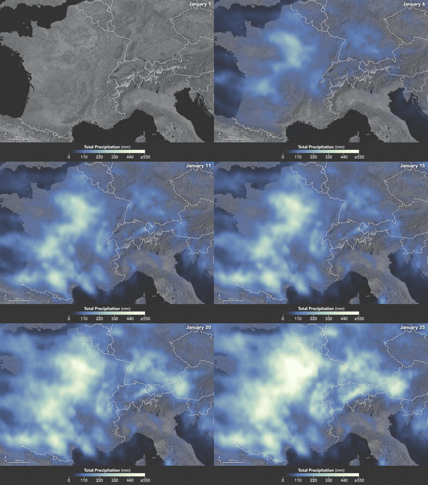
NASA: Precipitation in Western Europe from January 1 to 25, 2018.
February 4th, 2018The animation below depicts satellite-based measurements of precipitation in Western Europe from January 1 to 25, 2018. The brightest areas reflect the highest precipitation amounts. The measurements are a product of the Global Precipitation Measurement (GPM) mission, which is a partnership between NASA, the Japan Aerospace Exploration Agency, and five other national and international partners.

These precipitation totals are regional, remotely-sensed estimates of precipitation (liquid and frozen mix); they do not reflect pure snowfall. Each pixel shows 0.1 degrees of the globe (about 7 miles at the equator), and the data are averaged across each pixel. Individual ground-based measurements within a pixel can be significantly higher or lower than the average.
In addition to the snowfall in the mountains, rainfall has been frequent and severe in the lowlands, particularly in France. The Seine River crested at nearly 6 meters (20 feet) in Paris in late January. The warm winter in Europe also means that a fair bit of snow has been melting off and running downstream, even as fresh snow is piling up in the hills.
-
References
- Meteo France (2018, January) Hiver 2018 : une pluviométrie exceptionnelle. Accessed January 31, 2018.
- The Washington Post (2018, January 23) Heavy snow and avalanches strand thousands at ski villages across the Alps. Accessed January 31, 2018.
- Weather.com (2018, January 23) Heavy Snow Buries Davos, Switzerland, During Meeting of World Leaders. Accessed January 31, 2018.
- Weather Underground (2018, January 27) Floods, Record Warmth, High Winds: It’s the Winter of 2018, European Edition. Accessed January 31, 2018.
NASA Earth Observatory images by Joshua Stevens, using MODIS data from LANCE/EOSDIS Rapid Response and IMERG data from the Global Precipitation Mission (GPM) at NASA/GSFC. Caption by Mike Carlowicz.
- Instrument(s):
- Terra – MODIS
- GPM

