Archive for August, 2017
NASA: Harvey makes landfall and is now a Cat 3
Saturday, August 26th, 2017
NASA:
Residents along the coast of Texas braced for a potent hurricane to make landfall late on August 25. Forecasters believe the storm will be at major intensity (category 3 or higher) and will be the strongest to make landfall in the United States in 12 years. Hurricane Harvey was predicted to come ashore somewhere between Port O’Connor and Corpus Christi, Texas.
Forecast models were predicting rain accumulations of 15 to 30 inches (38 to 76 centimeters) in many places along the Texas coast, with localized totals up to 40 inches (100 centimeters). Significant rainfall, though somewhat less extreme, is expected inland. The storm system is expected to stall and linger for several days as it interacts with another weather front. In a forecast advisory on August 25, the National Hurricane Center (NHC) declared: “Rainfall of this magnitude will cause catastrophic and life-threatening flooding.”
The animation above shows Harvey as the hurricane evolved between 7:15 p.m. Central Daylight Time on August 24 and 3:15 p.m. on August 25. Infrared data (band 4) from Geostationary Operational Environmental Satellite 13 (GOES-13) is overlaid on a MODIS blue marble. The satellite is operated by the National Oceanic and Atmospheric Administration (NOAA), while NASA helps develop and launch the GOES series of satellites.
At 4 p.m. Central Daylight Time (19:00 Universal Time) on August 25, the National Hurricane Center reported that Harvey had maximum sustained winds of 125 miles (205 kilometers) per hour and a minimum central pressure of 941 millibars (27.79 inches). The category 3 hurricane was about 60 miles (95 kilometers) east-southeast of Corpus Christi, Texas; tropical storm force winds and outer rain bands were beginning to hit the Texas coast. Hurricane-force winds extended outward up to 35 miles (55 kilometers) from the center, and tropical storm winds stretched for 140 miles (220 kilometers).
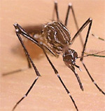
Brazil now faces a new threat: Oropouche fever.
Saturday, August 26th, 2017“…..The Oropouche virus, named for a river in Trinidad, where it was first isolated in 1955, circulates in monkeys and sloths in the Amazon jungle. The virus has caused occasional outbreaks, short but intense, in towns in tropical areas of Brazil, Peru and Panama, and on some Caribbean islands.
But in the last few years, Oropouche cases have turned up more often in urban areas, including some in northeast Brazil, where Zika began its explosive spread in this hemisphere.
Oropouche causes symptoms resembling those of dengue: high fever, headaches and joint pain, nausea and malaise. The infection is not normally fatal, although it can cause meningitis…….The virus is typically transmitted by a biting midge, Culicoides paraensis, that ranges from Argentina to as far north as Wisconsin……..”
Hurricane Harvey intensifies into a Category 4 storm nearing Corpus Christi
Saturday, August 26th, 2017000
WTNT34 KNHC 252356
TCPAT4
BULLETIN
Hurricane Harvey Intermediate Advisory Number 22A
NWS National Hurricane Center Miami FL AL092017
700 PM CDT Fri Aug 25 2017
…EYE OF CATEGORY 4 HARVEY APPROACHING THE COAST BETWEEN PORT
ARANSAS AND PORT O’CONNOR TEXAS…
…CATASTROPHIC FLOODING EXPECTED DUE TO HEAVY RAINFALL AND STORM
SURGE…
SUMMARY OF 700 PM CDT…0000 UTC…INFORMATION
———————————————-
LOCATION…27.8N 96.8W
ABOUT 35 MI…55 KM E OF CORPUS CHRISTI TEXAS
ABOUT 50 MI…80 KM SSW OF PORT OCONNOR TEXAS
MAXIMUM SUSTAINED WINDS…130 MPH…215 KM/H
PRESENT MOVEMENT…NW OR 325 DEGREES AT 8 MPH…13 KM/H
MINIMUM CENTRAL PRESSURE…941 MB…27.79 INCHES
WATCHES AND WARNINGS
——————–
CHANGES WITH THIS ADVISORY:
None.
SUMMARY OF WATCHES AND WARNINGS IN EFFECT:
A Storm Surge Warning is in effect for…
* Port Mansfield to High Island Texas
A Hurricane Warning is in effect for…
* Port Mansfield to Sargent Texas
A Tropical Storm Warning is in effect for…
* North of Sargent to High Island Texas
A Storm Surge Warning means there is a danger of life-threatening
inundation from rising water moving inland from the coastline in the
indicated locations. For a depiction of areas at risk, please see
the National Weather Service Storm Surge Watch/Warning Graphic,
available at hurricanes.gov. This is a life-threatening situation.
A Hurricane Warning means that hurricane conditions are expected
somewhere within the warning area, in this case within the next few
hours. Preparations to protect life and property should already be
complete.
Interests in southwestern Louisiana should continue to monitor the
progress of this system.
For storm information specific to your area, including possible
inland watches and warnings, please monitor products issued by your
local National Weather Service forecast office.
DISCUSSION AND 48-HOUR OUTLOOK
——————————
At 700 PM CDT (0000 UTC), the eye of Hurricane Harvey was located by
reconnaissance aircraft and NOAA Doppler radar near latitude 27.8
North, longitude 96.8 West. Harvey is moving toward the northwest
near 8 mph (13 km/h), but its forward speed is expected to decrease
during the next couple of days. On the forecast track, Harvey will
make landfall on the middle Texas coast during the next several
hours. Harvey is then likely to meander near or just inland of the
middle Texas coast through the weekend.
Reports from an Air Force Reserve Hurricane Hunter aircraft
indicate that maximum sustained winds remain near 130 mph
(215 km/h) with higher gusts. Harvey is a category 4 hurricane on
the Saffir-Simpson Hurricane Wind Scale. Little change in strength
is likely before landfall. Weakening is then expected over the
weekend while the center moves inland over Texas.
Hurricane-force winds extend outward up to 35 miles (55 km) from
the center, and tropical-storm-force winds extend outward up to 140
miles (220 km). A Texas Coastal Ocean Observing Network station at
Aransas Pass recently reported sustained winds of 79 mph (128 km/h)
and a wind gust of 101 mph (163 km/h).
The latest minimum central pressure reported by the Hurricane
Hunter aircraft is 941 mb (27.79 inches).
HAZARDS AFFECTING LAND
———————-
RAINFALL: Harvey is expected to produce total rain accumulations of
15 to 30 inches and isolated maximum amounts of 40 inches over the
middle and upper Texas coast through next Wednesday. During the same
time period Harvey is expected to produce total rain accumulations
of 5 to 15 inches in far south Texas and the Texas Hill Country over
through southwest and central Louisiana. Rainfall of this magnitude
will cause catastrophic and life-threatening flooding.
STORM SURGE: The combination of a dangerous storm surge and the
tide will cause normally dry areas near the coast to be flooded by
rising waters moving inland from the shoreline. The water is
expected to reach the following heights above ground if the peak
surge occurs at the time of high tide…
Port Aransas to Port O’Connor…9 to 13 ft
Elsewhere N Entrance Padre Island Natl Seashore to Sargent…6 to
12 ft
Sargent to Jamaica Beach…5 to 8 ft
Port Mansfield to N Entrance Padre Island Natl Seashore…3 to 5 ft
Jamaica Beach to High Island…2 to 4 ft
Mouth of the Rio Grande to Port Mansfield…1 to 3 ft
High Island to Morgan City…1 to 3 ft
The deepest water will occur along the immediate coast near and to
the northeast of the landfall location, where the surge will be
accompanied by large and destructive waves. Surge-related flooding
depends on the relative timing of the surge and the tidal cycle, and
can vary greatly over short distances. For information specific to
your area, please see products issued by your local National Weather
Service forecast office.
WIND: Hurricane conditions are occuring along the coast in
the Port Aransas area and should spread over other portions of the
hurricane warning area during the next several hours. Tropical
storm conditions are occurring in other portions of the hurricane
and tropical storm warning areas. Tropical storm conditions are
likely to persist along portions of the coast through at least
Sunday.
SURF: Swells generated by Harvey are affecting the Texas,
Louisiana, and northeast Mexico coasts. These swells are likely to
cause life-threatening surf and rip current conditions. Please
consult products from your local weather office.
TORNADOES: A few tornadoes are possible through Saturday near the
middle and upper Texas coast into far southwestern Louisiana.
NEXT ADVISORY
————-
Next complete advisory at 1000 PM CDT.
$$
Forecaster Beven
Myanmar: More than 70 people were killed on Friday in clashes between militants and security forces in Rakhine State.
Friday, August 25th, 2017- “…The dead included at least 12 members of the security forces and at least 59 Rohingya insurgents…”
- “…..The national commission, led by former UN Secretary-General Kofi Annan…. pressed the government to take “urgent and sustained action”, including improving the low socio-economic development in Rakhine State, resolving citizenship status and accelerating the national verification process and ensuring the freedom of movement for all people….”
Harvey forecast to slam Texas coast as major hurricane with ‘devastating’ flood potential
Friday, August 25th, 2017Hazardous marine condition(s):
Hurricane Warning
GMZ001-252100-
Synopsis for the Gulf of Mexico
454 AM EDT Fri Aug 25 2017
.SYNOPSIS…Hurricane Harvey is centered near 25.9N 95.4W at
25/0900 UTC, moving NW, or 320 degrees at 8 kt. Estimated minimun
central pressure is 967 mb. Maximum sustained winds are 90 kt
gusting to 110 kt. Harvey is forecast to reach near 26.9N 96.3W
this afternoon as a major hurricane with winds of 105 kt gusts
to 130 kt, and will be near 28.0N 97.1W tonight, then move inland
near 28.5N 97.4W Saturday afternoon. Harvey is then likely to
stall near or just inland of the middle Texas coast through the
remainder of the weekend.

Lower respiratory tract infections (LRIs) caused 2.74 million deaths worldwide in 2015, making them the fifth leading cause of death, and the second leading cause of death for children under the age of 5 years.
Friday, August 25th, 2017Estimates of the global, regional, and national morbidity, mortality, and aetiologies of lower respiratory tract infections in 195 countries: a systematic analysis for the Global Burden of Disease Study 2015
Troeger, Christopher et al.
The Lancet Infectious Diseases
“…..LRIs are the leading infectious cause of death and the fifth-leading cause of death overall; they are the second-leading cause of DALYs. At the global level, the burden of LRIs has decreased dramatically in the last 10 years in children younger than 5 years, although the burden in people older than 70 years has increased in many regions. LRI remains a largely preventable disease and cause of death, and continued efforts to decrease indoor and ambient air pollution, improve childhood nutrition, and scale up the use of the pneumococcal conjugate vaccine in children and adults will be essential in reducing the global burden of LRI….”