NASA: Before and after Hurricane Florence swept through the Carolinas
October 1st, 2018

The National Weather Service office in Raleigh offered a preliminary estimate that nearly 8 trillion gallons of rain fell on North Carolina from Sept 13 to 17, 2018. That led to catastrophic flooding across many parts of the state.
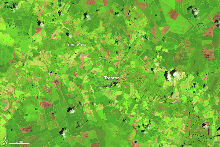
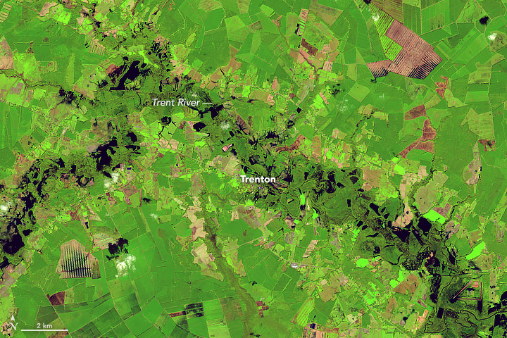
Before and after Hurricane Florence swept through the Carolinas, the Operational Land Imager (OLI) on the Landsat 8 satellite observed several residential areas and major rivers. The image pair above shows the Trent River on July 14, 2017, and September 19, 2018. These false-color images use a combination of visible and infrared light (OLI bands 6-5-4) to make it easier to distinguish between flood waters and land.
The Trent River reached an all-time high of 29 feet (8.8 meters) on September 17, more than twice the flood stage (the height at which the river will overflow and cause damage). Water levels decreased to 24 feet (7.3 meters) by September 20, but many homes, public buildings, and roads leading to the town of Trenton are full of standing water.


