Archive for September, 2019
Ebola virus disease – Democratic Republic of the Congo Disease outbreak news: Update (12 September 2019)
Saturday, September 14th, 2019The University of Toledo and the Lucas County Sheriff’s Office team up to provide training for situations of mass violence
Saturday, September 14th, 2019Extreme weather events displaced a record 7,000,000 people from their homes during the first six months of this year
Saturday, September 14th, 2019“…..floods, landslides, cyclones and other extreme weather events temporarily displaced more people in the first half of this year than during the same period in any other year...….”
IDMC’s mid-year figures reveal the most significant new internal displacements associated with conflict, violence and disasters around the world between January and June 2019. The report serves as an important temperature gauge of global displacement halfway through the year, looking ahead to the trends and patterns expected in the months to come.
POTENTIAL TROPICAL CYCLONE NINE
Friday, September 13th, 2019
000
WTNT34 KNHC 130857
TCPAT4
BULLETIN
Potential Tropical Cyclone Nine Advisory Number 3
NWS National Hurricane Center Miami FL AL092019
500 AM EDT Fri Sep 13 2019
…TROPICAL DISTURBANCE MOVING NORTHWESTWARD OVER THE CENTRAL
BAHAMAS…
…TROPICAL STORM WATCH EXTENDED NORTHWARD ON THE FLORIDA
PENINSULA…
SUMMARY OF 500 AM EDT…0900 UTC…INFORMATION
———————————————-
LOCATION…24.6N 75.2W
ABOUT 255 MI…410 KM ESE OF FREEPORT GRAND BAHAMA ISLAND
ABOUT 170 MI…275 KM SE OF GREAT ABACO ISLAND
MAXIMUM SUSTAINED WINDS…30 MPH…45 KM/H
PRESENT MOVEMENT…NW OR 315 DEGREES AT 6 MPH…9 KM/H
MINIMUM CENTRAL PRESSURE…1009 MB…29.80 INCHES
WATCHES AND WARNINGS
——————–
CHANGES WITH THIS ADVISORY:
A Tropical Storm Watch has been issued from the Volusia-Brevard
County line to the Flagler-Volusia County line.
SUMMARY OF WATCHES AND WARNINGS IN EFFECT:
A Tropical Storm Warning is in effect for…
* Northwestern Bahamas excluding Andros Island
A Tropical Storm Watch is in effect for…
* Jupiter Inlet to Flagler-Volusia County line
A Tropical Storm Warning means that tropical storm conditions are
expected somewhere within the warning area within 36 hours.
A Tropical Storm Watch means that tropical storm conditions are
possible within the watch area, generally within 48 hours.
Interests elsewhere along the east coast of Florida should monitor
the progress of this system. Additional watches and warnings may
be required for portions of this area later today.
For storm information specific to your area in the United States,
including possible inland watches and warnings, please monitor
products issued by your local National Weather Service forecast
office. For storm information specific to your area outside of the
United States, please monitor products issued by your national
meteorological service.
DISCUSSION AND OUTLOOK
———————-
At 500 AM EDT (0900 UTC), the disturbance was centered near latitude
24.6 North, longitude 75.2 West. The system is moving toward the
northwest near 6 mph (9 km/h), and this general motion is expected
to continue with some increase in forward speed through the
weekend. On the forecast track, the system is anticipated to move
across the central and northwestern Bahamas today, and along or
over the east coast of Florida Saturday and Saturday night.
Maximum sustained winds are near 30 mph (45 km/h) with higher gusts.
Some strengthening is forecast during the next 48 hours, and the
disturbance is forecast to become a tropical depression or a
tropical storm during the next day or so.
Environmental conditions are favorable for a tropical depression or
tropical storm to form within the next day or two.
* Formation chance through 48 hours…high…80 percent
* Formation chance through 5 days…high…90 percent
The estimated minimum central pressure is 1009 mb (29.80 inches).
HAZARDS AFFECTING LAND
———————-
WIND: Tropical storm conditions are expected within the warning
area in the northwestern Bahamas later today. Tropical storm
conditions are possible in the watch area on the Florida peninsula
by Saturday or Saturday night.
RAINFALL: The potential tropical cyclone is expected to produce
total rainfall accumulations through Sunday:
The Bahamas…2 to 4 inches, isolated maximum amounts 6 inches.
The U.S. Southeast Coast from central Florida into South
Carolina…2 to 4 inches.
STORM SURGE: This system is not expected to product significant
storm surge in the northwestern Bahamas.
NEXT ADVISORY
————-
Next intermediate advisory at 800 AM EDT.
Next complete advisory at 1100 AM EDT.
$$
Forecaster Beven
Hurricane Gilbert slams into Jamaica, killing hundreds of people, on September 12, 1988.
Thursday, September 12th, 2019Atlantic 2-Day Graphical Tropical Weather Outlook
Thursday, September 12th, 2019
ZCZC MIATWOAT ALL
TTAA00 KNHC DDHHMM
Tropical Weather Outlook
NWS National Hurricane Center Miami FL
200 AM EDT Thu Sep 12 2019
For the North Atlantic…Caribbean Sea and the Gulf of Mexico:
1. A trough of low pressure is producing widespread cloudiness,
showers, and thunderstorms that extend from the southeastern
Bahamas northeastward over the adjacent Atlantic waters. Although
limited development of this system is anticipated today, conditions
are forecast to become a little more conducive for tropical cyclone
formation over the weekend, and a tropical depression is likely to
form as the system moves northwestward at 5 to 10 mph across the
Florida Straits and southern Florida, and into the eastern Gulf
of Mexico. This disturbance will likely produce periods of locally
heavy rainfall and gusty winds across the Bahamas through Friday,
and across Florida during the weekend. An Air Force Reserve
reconnaissance aircraft is scheduled to investigate the system
this afternoon, if necessary.
* Formation chance through 48 hours…medium…50 percent.
* Formation chance through 5 days…high…70 percent.
2. A tropical wave located just west of the Cabo Verde Islands is
producing a small area of disorganized showers and thunderstorms.
Conditions appear conducive for development of this system, and a
tropical depression could form early next week while it moves
westward over the tropical Atlantic toward the Lesser Antilles.
* Formation chance through 48 hours…low…near 0 percent.
* Formation chance through 5 days…medium…40 percent.
Forecaster Berg
History of the Strategic National Stockpile
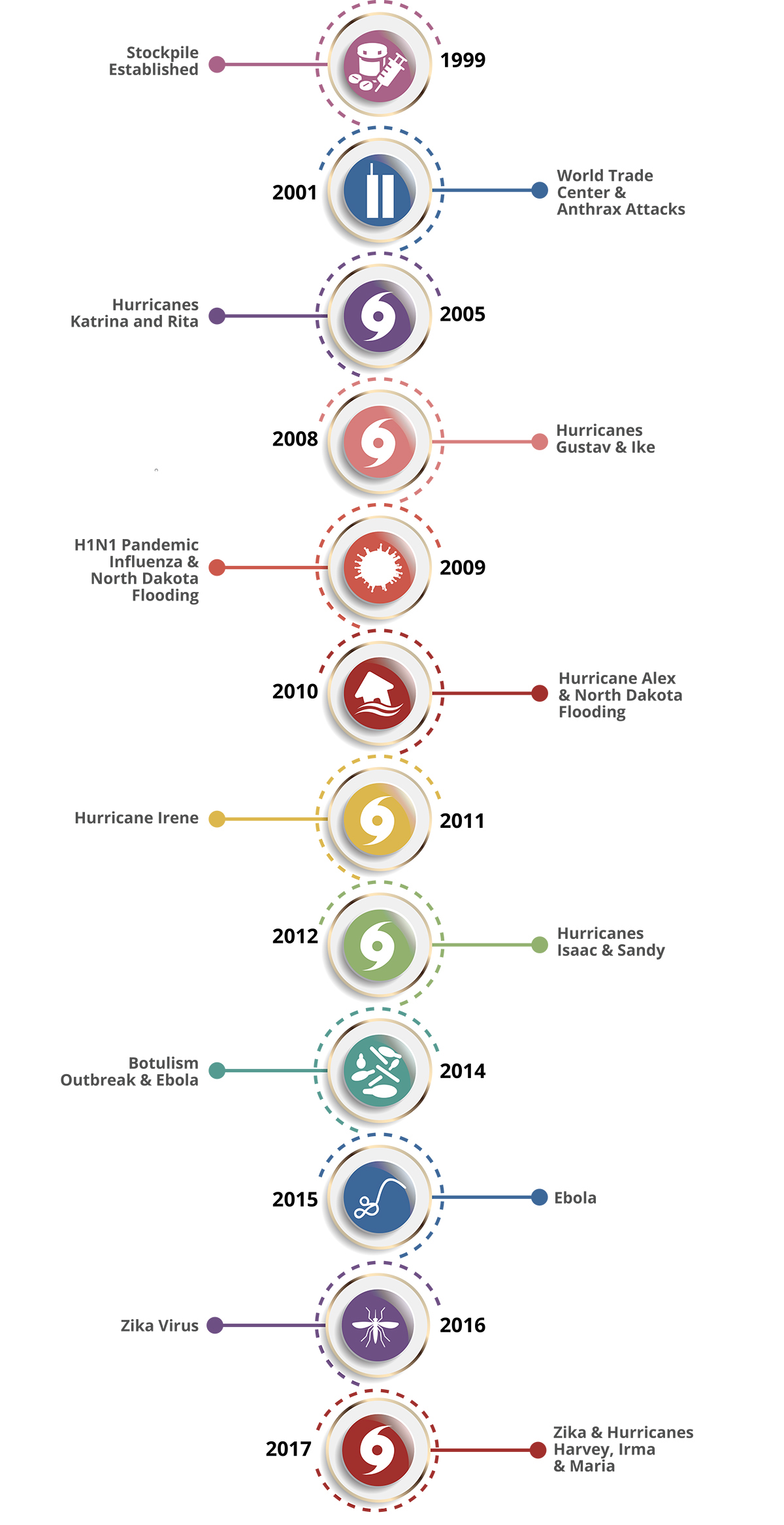
Thursday, September 12th, 2019The National Pharmaceutical Stockpile was created in 1999 to ensure the nation’s readiness against potential agents of bioterrorism like botulism, anthrax, smallpox, plague, viral hemorrhagic fevers, and tularemia. The mission was to assemble large quantities of essential medical supplies that could be delivered to states and communities during an emergency within 12 hours of the federal decision to use the stockpile.
The September 11, 2001, terrorist attacks prompted federal legislation and directives to strengthen public health emergency readiness. In 2003, the National Pharmaceutical Stockpile was renamed Strategic National Stockpile.
Today, the Strategic National Stockpile works with governmental and nongovernmental partners to upgrade the ability to respond to a national public health emergency, ensuring that federal, state, and local agencies are ready to receive, and stage and distribute products.
Since its beginning, the stockpile has responded to multiple large-scale emergencies including floods, hurricanes, and influenza pandemics. It has also supported various small-scale deployments for the treatment of individuals with life-threatening infectious diseases like anthrax, smallpox, and botulism.

Stockpile Products in the Strategic National Stockpile
Thursday, September 12th, 2019The majority of stockpile assets are held in storage and kept as managed inventory. Maintaining a supply of medications and medical supplies for specific health threats allows the stockpile to respond with the right product when a specific disease or agent is known.
Products in the stockpile may require an Emergency Use Authorization, which is granted by the U.S. Food and Drug Administration (FDA). The authorization allows for the emergency use of an unapproved medical product (e.g., drugs, vaccines, and devices) or unapproved use of an approved medical product to diagnose, treat, or prevent serious or life-threatening diseases or conditions for which no adequate, FDA-approved alternative is available.
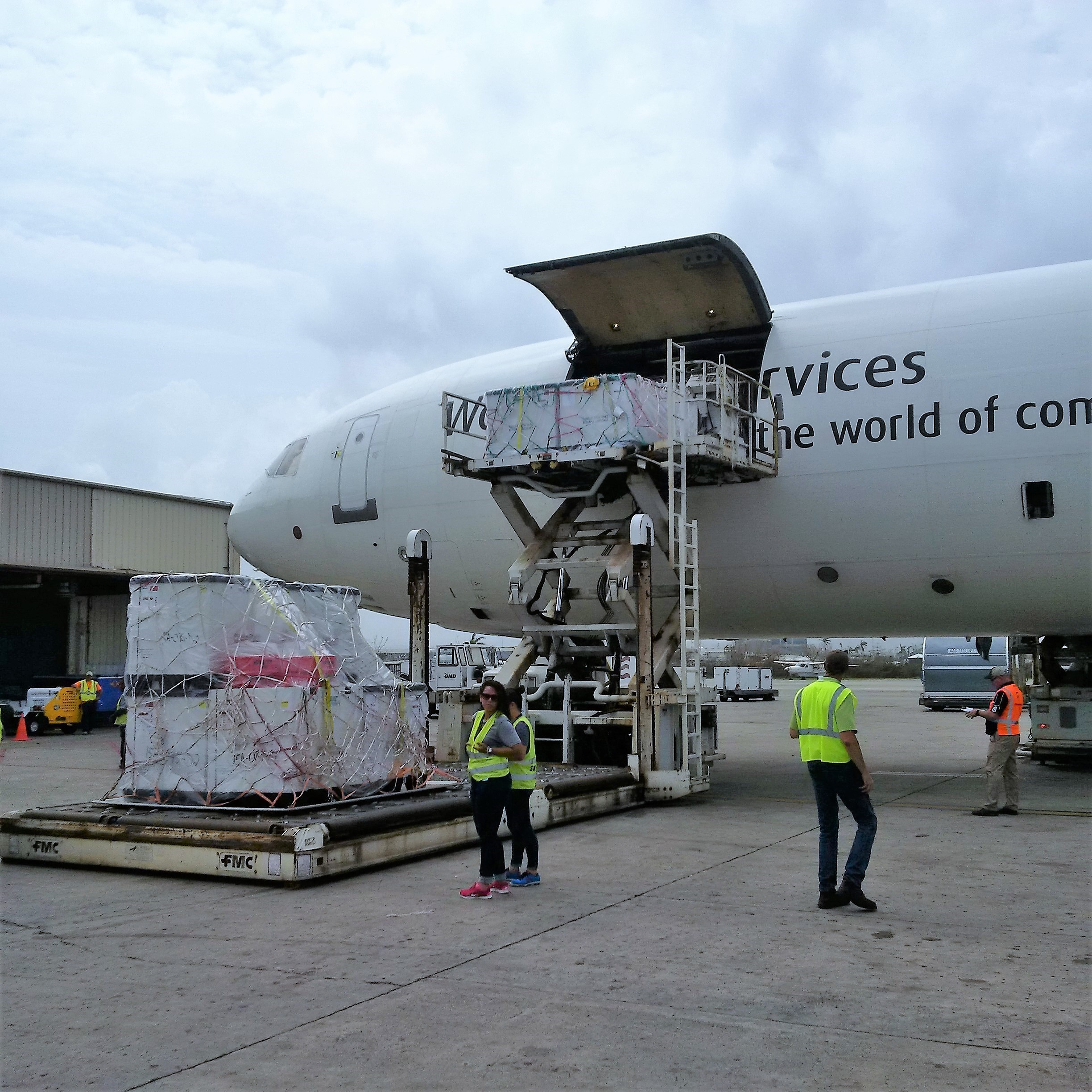
If a community experiences a large-scale public health incident in which the disease or agent is unknown, the first line of support from the stockpile is to send a broad-range of pharmaceuticals and medical supplies. Contents are pre-packed and configured in transport-ready containers for rapid delivery anywhere in the United States within 12 hours of the federal decision to deploy. Each package contains 50 tons of emergency medical resources.
The stockpile has medicines and supplies stored in strategically located warehouses throughout the country ready for deployment. Immediately shipping a variety of items to the affected state allows authorities to begin or sustain response efforts. All states have plans to receive and distribute these medical countermeasures quickly to local jurisdictions.

CHEMPACK
CHEMPACKs are containers of nerve agent antidotes placed in secure locations in local jurisdictions around the country to allow rapid response to a chemical incident. These medications treat the symptoms of nerve agent exposure and can be used even when the actual agent is unknown.
Because these antidotes must be administered quickly, the CHEMPACK team maintains 1,960 containers strategically placed in more than 1,340 locations in the United States. More than 90 percent of the U.S. population is within 1 hour of a CHEMPACK location. Most are located in hospitals or fire stations selected by local authorities to support a rapid hazmat response and can be accessed quickly if hospitals or first responders need them.
Nerve Agent EUA Information
On April 11, 2017, the U.S. Food and Drug Administration (FDA) issued an Emergency Use Authorization (EUA) to permit the emergency use of the 2 mg atropine auto-injector, manufactured by Rafa Laboratories, Ltd. On May 23, 2017, FDA amended the EUA to also permit the emergency use of pediatric strengths (i.e., 0.5 mg and 1 mg) of this atropine auto-injector. On January 24, 2018, FDA granted another EUA amendment to permit auto-injector administration through clothing. These products are included in CHEMPACK containers located across the United States. This specific atropine auto-injector is authorized for the initial treatment of symptoms of known or suspected poisoning in individuals exposed to nerve agents or certain insecticides (organophosphorus and/or carbamate). The original letter of authorization describes the scope and conditions of EUA that apply to all three strengths (0.5 mg, 1 mg and 2 mg) of this atropine auto-injector; the amendment letters are addenda to the original letter of authorization. The amended fact sheets dated January 24, 2018 (version 3) for healthcare providers and patients and caregivers are the current versions and available through FDA’s EUA website.
Federal Medical Stations
Somewhere between a temporary shelter and temporary hospital, a Federal Medical Station is a non-emergency medical center set up during a natural disaster to care for displaced persons with special health needs—including those with chronic health conditions, limited mobility, or common mental health issues—that cannot be met in a shelter for the general population during an incident.
The modular and rapidly deployable reserve of beds, supplies, and medicines provides equipment to care for 50–250 people for 3 days before resupply is needed. Flexible and scalable, it can be tailored to meet the requirements of each incident and has the ability to increase local healthcare capabilities in mass casualty events or in response to potential public health threats.
Federal Medical Stations operate through the cooperation of federal, state, and local authorities and require pre-planning and pre-identification of potential locations, based on specific selection criteria. Prior to an emergency event, state, local, tribal, and territorial agencies collaborate with the U.S. Department of Health and Human Services Regional Emergency Coordinators to survey sites and identify any gaps that may need addressing during a response.


