Archive for the ‘Fires/Wildfires’ Category
A wildfire in the Santa Clarita Valley area has grown to more than 20,000 acres
Sunday, July 24th, 2016At least 1,500 homes are threatened.
The Sand Fire near Santa Clarita has consumed 3000 acres in 1 day
Saturday, July 23rd, 2016New wildfires erupted Monday near Los Angeles
Tuesday, June 21st, 2016National Preparedness Level
Level 2
National Fire Activity
Initial attack activity: Light (100 new fires)
New large incidents: 2
Large fires contained: 1
Uncontained large fires: 15
Area Command Teams Committed: 0
NIMOs committed: 1
Type 1 IMTs committed: 3
Type 2 IMTs committed: 2
Source:
Incident Management Situation Report

Five major wildfires across the desert Southwest
Monday, June 20th, 2016
Level 2
National Fire Activity
Initial attack activity: Light (40 new fires)
New large incidents: 4
Large fires contained: 3
Uncontained large fires: 13
Area Command Teams Committed: 0
NIMOs committed: 0
Type 1 IMTs committed: 3
Type 2 IMTs committed: 2
Source:
Incident Management Situation Report
https://www.youtube.com/watch?v=LvgY9wruF_I
The Sherpa fire in Santa Barbara County has grown to nearly 6,000 acres
Saturday, June 18th, 2016| Sherpa Fire Incident Information: | ||
| Last Updated: | June 17, 2016 8:00 am | |
| Date/Time Started: | June 15, 2016 3:21 pm | |
| Administrative Unit: | U.S Los Padres National Forest | |
| County: | Santa Barbara County | |
| Location: | off of Refugio Road, in the vicinity of the Sherpa Ranch | |
| Acres Burned – Containment: | 4,000 acres – 5% contained ***CAL FIRE is in Unified Command with the USFS and Santa Barbara County Fire. | |
| Long/Lat: | -119.643, 34.776 | |
June 15, 1904: More than 1,000 people died when fire erupted aboard the steamboat General Slocum in New York City’s East River.
Wednesday, June 15th, 2016Learn about Public Safety Canada
Sunday, May 15th, 2016Learn about how Public Safety Canada engages at all levels during a crisis to ensure the best outcome for Canadians.
Responding to emergency events
If an emergency escalates beyond the capabilities of the provincial or territorial government, assistance may be provided by the federal government. Find out more about the process and the types of support that could be offered.
Government Operations Centre
The Government Operations Centre (GOC), housed at Public Safety Canada, leads and coordinates the federal response during a crisis on behalf of the Government of Canada.
Provincial and Territorial emergency management organizations
Provincial and territorial emergency management organizations (EMOs) are a good source of information about how to prepare for emergencies in your region.
Disaster Financial Assistance Arrangements
The Government of Canada provides cost-shared financial assistance, administered by Public Safety Canada, to provincial and territorial governments to help with extraordinary costs incurred by large scale natural disasters.
Get Prepared
All Canadians have a role in building resilient communities, helping to keep hazards from becoming disasters, and in recovering from disasters when they do happen. Find out how to prepare for risks in your region.
Acts and Regulations
- Emergency Management Act
- Emergency Management Framework for Canada
- Federal Policy for Emergency Management
- Date modified:
- 2016-05-06
NASA: The Alberta wildfire smoke becomes entrained within the clouds causing it to twist within the circular motion of the clouds and wind.
Wednesday, May 11th, 2016
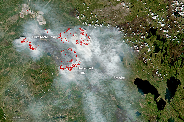
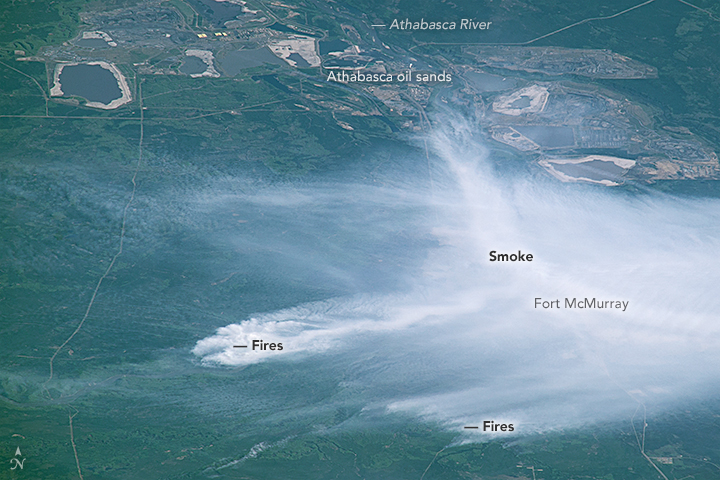
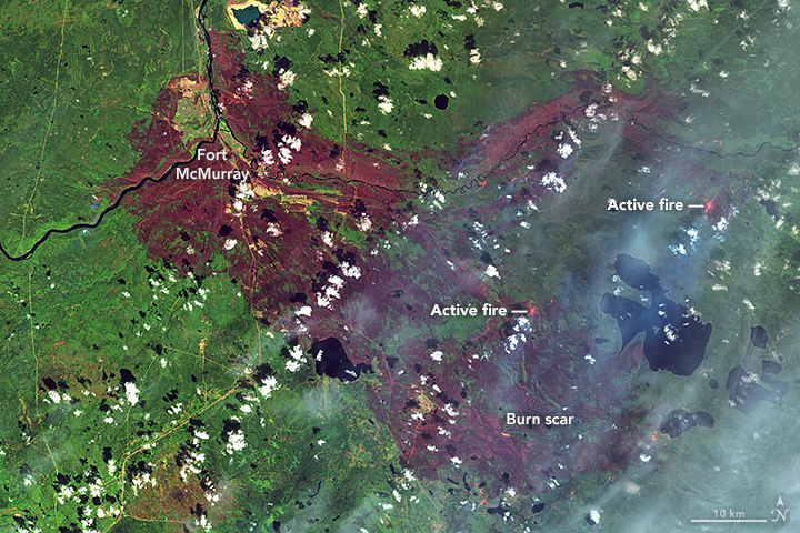
NASA’s Aqua satellite captured this image of the clouds over Canada. Entwined within the clouds is the smoke billowing up from the wildfires that are currently burning across a large expanse of the country. The smoke has become entrained within the clouds causing it to twist within the circular motion of the clouds and wind. This image was taken by the Moderate Resolution Imaging Spectroradiometer (MODIS) instrument on the Aqua satellite on May 9, 2016.
Image Credit: NASA image courtesy Jeff Schmaltz LANCE/EOSDIS MODIS Rapid Response Team, GSFC
Caption: Lynn Jenner


