Archive for the ‘Tropical storms’ Category
Climate change: Vibrio vulnificus reaches Delaware Bay
Wednesday, June 19th, 2019“…..In the past two years, five cases of Vibrio vulnificus, a flesh-eating bacterial infection that is spread by handling or eating contaminated seafood, have been linked to Delaware Bay……
Vibrio vulnificus usually occurs in high-salinity, brackish waters with surface temperatures above 13 degrees Celsius, or 55 degrees Fahrenheit, the study says. It has typically been found in the warm waters of the Gulf Coast and southern states like Louisiana and Texas, especially during the months from May to October.
Vibrio vulnificus causes about 205 infections in the United States every year the CDC estimates. The CDC also said it is important to learn more about the harmful bacteria if you live in areas where hurricanes, storm surges and coastal flooding are possible. The most common cause of infection is eating raw or undercooked shellfish, particularly oysters…..”
King M, Rose L, Fraimow H, Nagori M, Danish M, Doktor K. Vibrio vulnificus Infections From a Previously Nonendemic Area. Ann Intern Med. [Epub ahead of print 18 June 2019] doi: 10.7326/L19-0133

VAYU
Sunday, June 16th, 2019
PRESS RELEASE-7
Time of issue: 1530 hours IST Dated: 15-06-2019
Sub: Very Severe Cyclonic Storm ‘VAYU’ over northeast & adjoining eastcentral Arabian Sea
Yesterday’s very severe cyclonic storm “VAYU” over northeast & adjoining eastcentral Arabian Sea (AS) moved nearly westwards during past 24 hours and lay centred at 1430 hrs IST of today, the 15th June, 2019 near latitude 20.7°N and longitude 66.7°E over the same region about 325 km west-southwest of Porbandar (Gujarat), 380 km west-southwest of Veraval (Gujarat) and 435 km nearly west of Diu.
The system is very likely to move nearly westwards during next 24 hours with gradual weakening and recurve northeastwards thereafter and cross north Gujarat coast as a Depression by the evening of 17th June 2019.
Forecast track and intensity are given in the following table: Date/Time(IST) Position (Lat. 0N/ long. 0E) Maximum sustained surface wind speed (Kmph)
Category of cyclonic disturbance
15.06.19/1430 20.7/66.7 120-130 gusting to 145
Very Severe Cyclonic Storm 15.06.19/1730 20.7/66.4 120-130 gusting to 145
Very Severe Cyclonic Storm 15.06.19/2330 20.7/66.0 120-130 gusting to 145
Very Severe Cyclonic Storm 16.06.19/0530 20.9/65.7 100-110 gusting to 125
Severe Cyclonic Storm 16.06.19/1130 21.2/65.9 100-110 gusting to 125
Severe Cyclonic Storm 16.06.19/2330 21.8/66.6 80-90 gusting to 100
Cyclonic Storm 17.06.19/1130 22.5/67.6 55-65 gusting to 75
Deep Depression 17.06.19/2330 23.5/69.0 40-50 gusting to 60 Depression

Tropical Cyclone Vayu is barreling toward the northwest coast of India and is expected to pass close to the Gujarat coast on Thursday.
Thursday, June 13th, 2019


A disturbance in the Gulf
Tuesday, June 4th, 2019

000
ABNT20 KNHC 041134
TWOAT
Tropical Weather Outlook
NWS National Hurricane Center Miami FL
800 AM EDT Tue Jun 4 2019
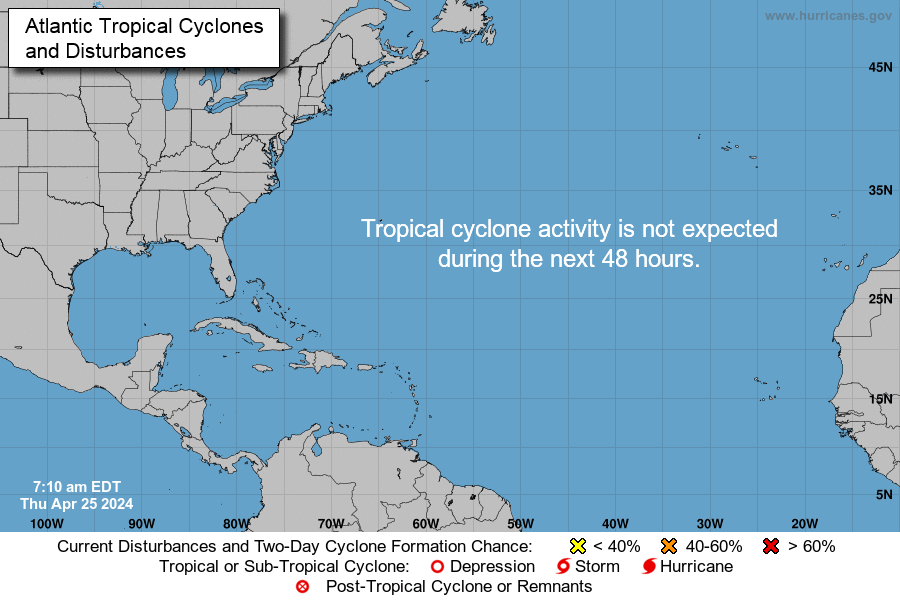
For the North Atlantic…Caribbean Sea and the Gulf of Mexico:
Shower and thunderstorm activity associated with a broad area of low
pressure located over the southwestern Gulf of Mexico has decreased
since yesterday and remains disorganized. This system could briefly
become a tropical depression before moving inland over northeastern
Mexico later today or tonight. Regardless of development, the
disturbance will likely produce heavy rainfall over portions of
eastern Mexico, southeastern Texas and the Lower Mississippi Valley
during the next few days. An Air Force Reserve reconnaissance
aircraft is scheduled to investigate the disturbance later today, if
necessary. Interests along the Gulf coast of Mexico should monitor
the progress of this system. For more information about the
rainfall threat in the United States, please see products issued by
your local forecast office and the Weather Prediction Center.
* Formation chance through 48 hours…medium…40 percent.
* Formation chance through 5 days…medium…40 percent.
$$
Forecaster Zelinsky
Atlantic Hurricane Season Begins Today
Saturday, June 1st, 2019“…..NOAA’s Climate Prediction Center is predicting that a near-normal Atlantic hurricane season is most likely this year. This outlook forecasts a 40% chance of a near-normal season, a 30% chance of an above-normal season and a 30% chance of a below-normal season. The hurricane season officially extends from June 1 to November 30.
For 2019, NOAA predicts a likely range of 9 to 15 named storms (winds of 39 mph or higher), of which 4 to 8 could become hurricanes (winds of 74 mph or higher), including 2 to 4 major hurricanes (category 3, 4 or 5; with winds of 111 mph or higher). NOAA provides these ranges with a 70% confidence. An average hurricane season produces 12 named storms, of which 6 become hurricanes, including 3 major hurricanes……”

Tuberculosis, Hurricane Maria, and Puerto Rico, 2017
Thursday, January 24th, 2019“On September 20, 2017, Hurricane Maria made landfall in Puerto Rico as a Category 4 storm, with sustained winds of 130–156 miles per hour, and 15–40 inches of rain causing catastrophic flash floods. The storm destroyed electricity and communication systems, left large areas without water service, and caused widespread damage to critical infrastructure, transportation, health care, and agriculture. On the sixth day after the event, 58 (84%) of 69 hospitals on the island had no electric power or fuel for generators (1). The devastation led to declaration of a major disaster, just 10 days after a similar declaration for Hurricane Irma, a Category 5 storm that left 1 million Puerto Ricans without electricity after its center passed approximately 57 miles north of Puerto Rico (2,3). Although the island’s entire population was affected by Hurricane Maria, the poorer, more remote, and economically disadvantaged communities, as well as those with larger numbers of bedridden and elderly persons, fared worse (4) because they had less access to already depleted health care services, more fragile homes, and no alternative means for electricity generation…….”
12/4/2012: Bopha, a Category 5 typhoon nicknamed “Pablo,” struck the Philippines and the flood waters destroyed entire villages and killed over 1000 people
Tuesday, December 4th, 2018https://www.youtube.com/watch?v=MmIXVIPu4Ws


