Archive for the ‘Tropical storms’ Category
Extreme weather is striking parts of Asia with deadly flash-flooding in Vietnam, a tropical storm prompting evacuations and disrupting travel in China and an ongoing heat wave in Japan.
Monday, July 23rd, 2018https://www.youtube.com/watch?v=uOAoCumrC8E
Typhoon Maria is expected to make landfall in eastern China on July 11
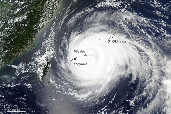
Wednesday, July 11th, 2018Once a super typhoon, the still powerful Typhoon Maria is expected to make landfall in eastern China on July 11, 2018, with damaging winds and heavy rains. Schools and factories in the city of Fuzhou have been closed; more than 140,000 residents have been evacuated from coastal and low-lying areas; and fishing boats have returned to port in anticipation of the typhoon’s arrival.
Chris is starting its climb along the Atlantic coastline
Monday, July 9th, 2018


000
WTNT33 KNHC 091455
TCPAT3
BULLETIN
Tropical Storm Chris Advisory Number 12
NWS National Hurricane Center Miami FL AL032018
1100 AM EDT Mon Jul 09 2018
…CHRIS MOVING LITTLE WELL OFFSHORE OF THE CAROLINAS…
…EXPECTED TO BECOME A HURRICANE ON TUESDAY…
SUMMARY OF 1100 AM EDT…1500 UTC…INFORMATION
———————————————–
LOCATION…32.2N 74.5W
ABOUT 215 MI…345 KM SSE OF CAPE HATTERAS NORTH CAROLINA
MAXIMUM SUSTAINED WINDS…60 MPH…95 KM/H
PRESENT MOVEMENT…STATIONARY
MINIMUM CENTRAL PRESSURE…999 MB…29.50 INCHES
WATCHES AND WARNINGS
——————–
There are no coastal watches or warnings in effect.
Interests along the coast of North Carolina should monitor the
progress of this system.
DISCUSSION AND OUTLOOK
———————-
At 1100 AM EDT (1500 UTC), the center of Tropical Storm Chris was
located near latitude 32.2 North, longitude 74.5 West. Chris has
been nearly stationary the past several hours, and little motion is
expected during the next day or so. A northeastward motion is
forecast to begin late Tuesday, and Chris is forecast to accelerate
northeastward on Wednesday and Thursday.
Reports from a NOAA reconnaissance aircraft indicate that maximum
sustained winds remain near 60 mph (95 km/h) with higher gusts.
However, strengthening is expected to begin by tonight and continue
for the next couple of days, and Chris is forecast to become a
hurricane on Tuesday.
Tropical-storm-force winds extend outward up to 70 miles (110 km)
from the center. During the past few hours, NOAA buoy 41002 located
just southwest of the center reported a sustained wind of 49 mph
(79 km/h) and a gust to 59 mph (94 km/h).
The estimated minimum central pressure based on data from a NOAA
reconnaissance aircraft is 999 mb (29.50 inches).
HAZARDS AFFECTING LAND
———————-
SURF: Swells generated by Chris are expected to increase and affect
portions of the coasts of North Carolina and the mid-Atlantic states
during the next few days. These swells could cause life-threatening
surf and rip current conditions. Please consult products from your
local weather office.


