Archive for the ‘Tropical storms’ Category
NASA: Satellite Images of Dorian
Friday, August 30th, 2019
NASA: “This image shows estimated rainfall accumulations for the region affected by Hurricane Dorian over the 24 hour period of Aug.27 11:59 UTC to Aug. 28 11:59 UTC.”

“On Aug. 27 at 1:35 p.m. EDT (1735 UTC), the AIRS instrument aboard NASA’s Aqua satellite analyzed cloud top temperatures of Tropical Storm Dorian in infrared light. AIRS found coldest cloud top temperatures (purple) of strongest thunderstorms were as cold as or colder than minus 63 degrees Fahrenheit (minus 53 degrees Celsius).” Credit: NASA JPL/Heidar Thrastarson
August 29, 2005: Hurricane Katrina makes landfall near New Orleans, Louisiana, as a Category 4 hurricane.
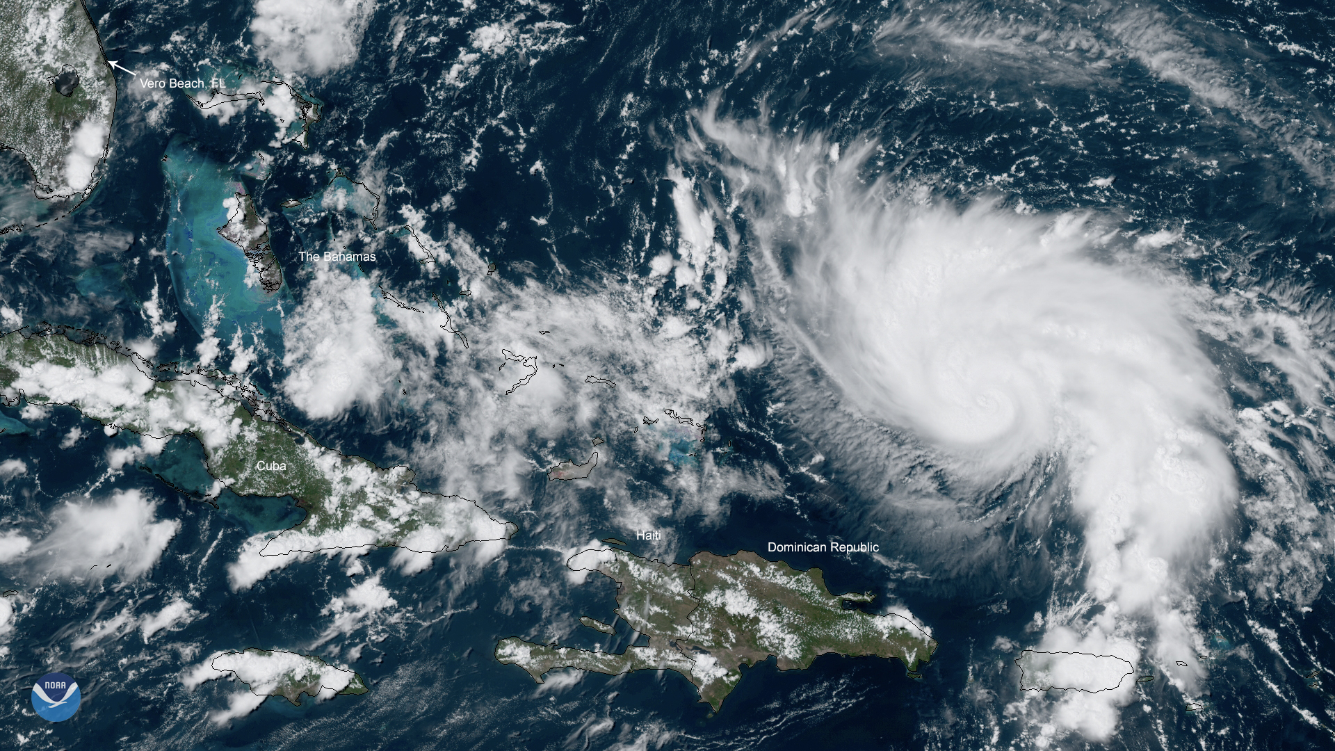
Thursday, August 29th, 2019Hurricane Dorian hitting Puerto Rico and The Virgin Islands
Wednesday, August 28th, 2019“…..Hurricane conditions are ongoing over portions of the US Virgin Islands, and could still occur over Vieques, Culebra, and the British Virgin Islands during the next several hours, according to NWS. These winds should subside tonight.
Meanwhile, tropical storm conditions are expected in Puerto Rico through tonight……”
DORIAN HAS SHOWN LITTLE CHANGE IN STRENGTH BUT IS EXPECTED TO STRENGTHEN BEFORE REACHING PUERTO RICO ON WEDNESDAY…
Wednesday, August 28th, 2019
DEPRESSION BECOMES TROPICAL STORM ERIN… …FORECAST TO MOVE NORTHWARD AND NORTHEASTWARD OVER THE OPEN ATLANTIC
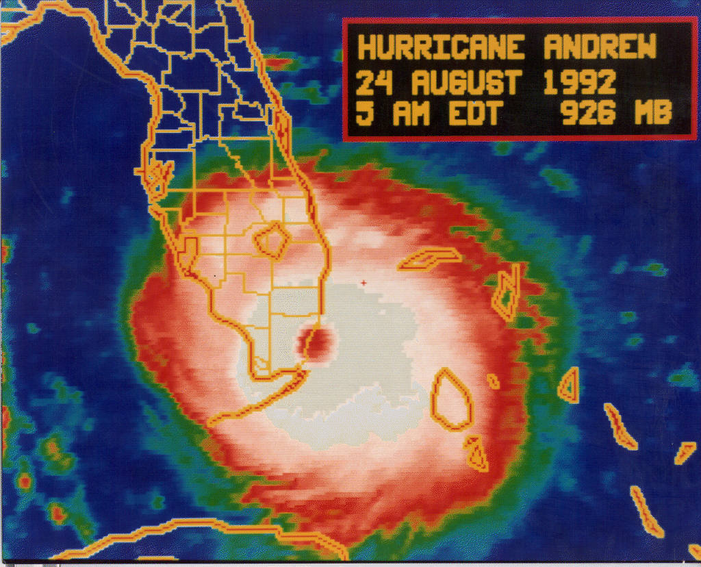
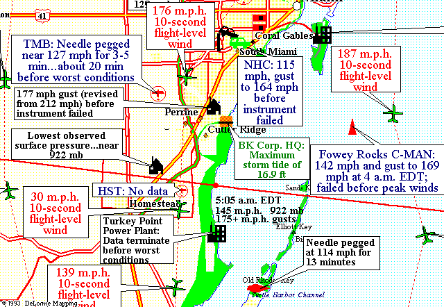
Wednesday, August 28th, 20198/24/1992: Hurricane Andrew makes landfall at 4:52 a.m. 25 miles south of Miami.
Saturday, August 24th, 2019
“……Its $47.8 billion worth of devastation no longer ranks it as the most costly natural disaster in American history. But it is probably the most impactful storm to ever hit the U.S.Andrew’s legacy is felt in weather forecasting, building codes and emergency management. When people began crawling out of the debris that morning, they quickly discovered the government was nowhere near prepared…..
Part of the post-disaster disaster was due to complacency. Only two Category 5 hurricanes had ever hit the U.S., and nobody foresaw Andrew turning into a 175-mph monster……
Almost 26,000 homes were totally destroyed, and 102,000 more were damaged. The number of homeless was 160,000, though that didn’t include hundreds of monkeys, snakes, llamas, birds, cougars and other wildlife that escaped from zoos.
Prices for food, batteries, generators and ice soared since there were no laws against gouging. Looters descended and property owners armed themselves to protect what was left of their homes……”

The last radar image taken from NHC before the WSR-57 radar was blown off the roof, 0835 UTC August 24, 1992.


![[Image of probabilities of 34-kt winds]](https://www.nhc.noaa.gov/storm_graphics/AT06/refresh/AL062019_wind_probs_34_F120+png/024437.png)


