Archive for the ‘Tropical cyclones’ Category
Jebi hitting Japan: Strongest typhoon in 25 years
Tuesday, September 4th, 2018-
At least six deaths and 160 injuries.
-
Heavy rain and reports of winds up to 172km/h (107mph).
-
In Osaka Bay it swept a tanker into a bridge
-
In Kyoto parts of a railway station roof came down.
-
Officials ordered more than a million people in affected areas to evacuate their homes.
-
It has already left tens of thousands without power .

Puerto Rico: US now estimates that 2,975 people died as a result of the Hurricane Maria and its effects
Wednesday, August 29th, 20188/29/2005: Katrina, the worst natural disaster in the history of the United States, makes landfall near New Orleans.
Wednesday, August 29th, 2018Lane’s impact on Hawaii
Sunday, August 26th, 2018Impacts
• Shelters / Occupants: 3 (-31) / 85 (-1,017) (ARC Midnight Shelter Count as of 6:45 am EDT August 26)
• Closures o State government offices beginning to return to normal operations o Federal buildings will re-open on August 27 o Schools will re-open on August 27 except for 4 Maui schools
• Transportation o All state routes in Hawaii County are open; minor road flooding and debris obstructions reported across the state o Bus service at limited schedules across all islands, resuming normal operations
Response State / Local
• HI EOC at Partial Activation (Kilauea lava flow and Tropical Storm Lane)
• County EOC Activations o Hawaii County – Full Activation o City and County of Honolulu (Oahu) – Partial Activation o Maui – Normal Operations o Kauai County – Monitoring
• Commodities pre-staged across all the islands with sufficient food available
Federal Response FEMA Region IX
• RWC at Enhanced Watch (24/7)
• IMAT-1 deployed to HI (Kilauea lava flow & Hurricane Lane)
• LNOs deployed to all county EOCs
• Region VII IMAT deployed to Oakland, CA (Hurricane Lane) FEMA HQ
• NRCC de-activated
• FEMA NWC at Enhanced Watch (8:00 a.m. to 8:00 p.m. EDT)
• MERS: Bothell MERS deployed to Honolulu, Hilo, Wailuku and Lihue; Denver MERS deployed to Honolulu
• ISBs established in Maui, Kona, and Kauai • Reservist from HLT supporting / monitoring in HI US&R
• Federal Search and Rescue Coordination Group deployed to Honolulu
• Incident Support Team (IST) White deployed to Honolulu
• Three NIMS Type 3 US&R Task Forces deployed to Hawaii: CA-TF8 (Kauai), CA-TF3 (Oahu), and WA-TF1 (Maui)
• Six US&R Mission Ready Packages – Water Operations are on Alert
• Cache for Kauai team arrived at the Honolulu airport on August 25 USACE • Staff (56 (+2) personnel) on Oahu and Kauai including two USACE Power Planning and Response Teams (PRT); two 249th Prime Power Teams; and a Debris PRT
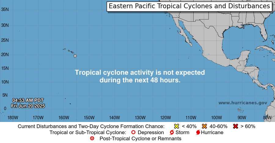
Miriam
Sunday, August 26th, 2018
387
WTPZ35 KNHC 261438
TCPEP5
BULLETIN
Tropical Storm Miriam Advisory Number 2
NWS National Hurricane Center Miami FL EP152018
800 AM PDT Sun Aug 26 2018
…DEPRESSION STRENGTHENS INTO A TROPICAL STORM…
SUMMARY OF 800 AM PDT…1500 UTC…INFORMATION
———————————————-
LOCATION…13.2N 125.3W
ABOUT 1210 MI…1950 KM WSW OF THE SOUTHERN TIP OF BAJA CALIFORNIA
MAXIMUM SUSTAINED WINDS…45 MPH…75 KM/H
PRESENT MOVEMENT…W OR 275 DEGREES AT 13 MPH…20 KM/H
MINIMUM CENTRAL PRESSURE…1004 MB…29.65 INCHES
WATCHES AND WARNINGS
——————–
There are no coastal watches or warnings in effect.
DISCUSSION AND OUTLOOK
———————-
At 800 AM PDT (1500 UTC), the center of Tropical Storm Miriam was
located near latitude 13.2 North, longitude 125.3 West. Miriam is
moving toward the west near 13 mph (20 km/h), and this general
motion is expected to continue for the next few days.
Maximum sustained winds have increased to near 45 mph (75 km/h)
with higher gusts. Steady strengthening is forecast during the
next the next few days, and Miriam is expected to become a
hurricane late Monday or Monday night.
Tropical-storm-force winds extend outward up to 35 miles (55 km)
from the center.
The estimated minimum central pressure is 1004 mb (29.65 inches).
HAZARDS AFFECTING LAND
———————-
None.
NEXT ADVISORY
————-
Next complete advisory at 200 PM PDT.
$$
Forecaster Brown
Lane dumped the fourth-highest amount of rain for a hurricane to hit the U.S. since 1950
Sunday, August 26th, 2018
WTPA32 PHFO 261439
TCPCP2
BULLETIN
Tropical Depression Lane Advisory Number 49
NWS Central Pacific Hurricane Center Honolulu HI EP142018
500 AM HST Sun Aug 26 2018
…LANE WEAKENS TO A DEPRESSION…
SUMMARY OF 500 AM HST…1500 UTC…INFORMATION
———————————————-
LOCATION…19.1N 162.2W
ABOUT 315 MI…510 KM WSW OF HONOLULU HAWAII
ABOUT 270 MI…435 KM SW OF LIHUE HAWAII
MAXIMUM SUSTAINED WINDS…35 MPH…55 KM/H
PRESENT MOVEMENT…W OR 260 DEGREES AT 10 MPH…17 KM/H
MINIMUM CENTRAL PRESSURE…1006 MB…29.71 INCHES
WATCHES AND WARNINGS
——————–
CHANGES WITH THIS ADVISORY:
None.
SUMMARY OF WATCHES AND WARNINGS IN EFFECT:
There are no coastal watches or warnings in effect.
Interests in the Northwestern Hawaiian Islands should
continue to monitor the progress of Lane.
DISCUSSION AND OUTLOOK
———————-
At 500 AM HST (1500 UTC), the center of Tropical Depression Lane was
located near latitude 19.1 North, longitude 162.2 West. The
depression is moving toward the west near 10 mph (17 km/h), and this
general motion is expected to continue into Monday. A brief slowing
in forward motion is expected Monday night as Lane makes a turn
toward the northwest. Lane is then expected to accelerate
northwestward by Tuesday as it transitions to an extratropical low.
Maximum sustained winds are near 35 mph (55 km/h) with higher gusts.
Some weakening is forecast during the next 48 hours, and Lane is
expected to become a post-tropical remnant low later today or
tonight. In a couple of days, Lane may develop into a gale force
extratropical low as it passes over portions of the Northwestern
Hawaiian Islands.
The estimated minimum central pressure is 1006 mb (29.71 inches).
HAZARDS AFFECTING LAND
———————-
RAINFALL: Lingering moisture associated with Lane will produce heavy
rainfall over portions of the main Hawaiian Islands today, which
could lead to additional flash flooding and landslides.
NEXT ADVISORY
————-
Next complete advisory at 1100 AM HST.
$$
Forecaster Birchard
Hurricane-proofing a Nantucket hospital
Sunday, August 19th, 2018By Cynthia McCormick
The Cape Cod Times

- The 106,000-square-foot, 14-bed hospital is being built to hurricane design specifications established by Miami-Dade County
- Will allow the hospital to withstand Hurricane Irma-strength winds of 185 mph, rather than 150 mph as specified by Massachusetts building codes
- Massive 5-foot-by-5-foot concrete footings fortified by mesh
- Andersen Stormwatch windows
- A double-hulled exterior building shell will help the new hospital stand up to Category 5 winds
- Analog and digital phone lines
- Access to satellite phones
- The new Nantucket Cottage Hospital won’t even have a basement.
- The boiler room, currently located in the basement of the existing hospital, will be shackled to the flat roof of the new hospital, including two massive generators
- Electrical transformer switches will be located on the second floor instead of the first
- The fuel-pumping room is being built at grade level, but will have waterproof curbing like an inverted bathtub
- The six-over-six Andersen windows have multiple fastenings and have withstood objects hurled by hurricane-force winds in ballistic tests
- The shell of the building is constructed almost like two walls, with a water and vapor barrier between the inner and outer skin
- will have a larger capacity to go days without supplies
- will have enough food for seven to 10 days and generator fuel for many days
- will have 27,000 gallons of fuel on-site for the dual-purpose generators, more than three times the current capacity of 8,000 gallons of oil and propane
- The final cost is estimated to run about $120 million


